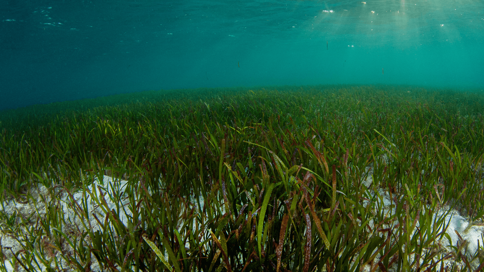
Abu Dabbab Bay
Known for its sandy bottom and extensive seagrass meadows, this site is a primary location for observing green sea turtles and the occasional dugong.
Look for turtles feeding in the shallower seagrass patches.

Marsa Alam's 60-kilometer coastline holds more than twenty named snorkeling sites, but shore access, marine park boundaries, and reef conditions vary sharply by location. This guide maps each site with GPS coordinates, entry points, and the protected zones that require permits or boat access.
Quick answer
A marsa alam snorkeling map divides the coast into three zones: the northern bay cluster from Abu Dabbab to Marsa Mubarak (free shore access, turtles and dugongs), the central hotel reef strip at Marsa Alam town (house reefs, depth 2–12 meters), and the southern marine parks including Wadi el-Gemal and Samadai Reef (permit required, boat-only). Public beaches remain free; protected reserves charge separate entry fees ranging from 5 to 15 EUR per person.
The Egyptian Red Sea Protectorates Authority divides Marsa Alam's underwater geography into regulated marine park sectors and open-access coastal zones, a distinction that determines where snorkelers may enter the water independently and where boat transport becomes mandatory. Abu Dabbab Bay, located 25 kilometers north of Marsa Alam town at GPS coordinates 25.3356°N, 34.7447°E, remains the most frequented shore-entry site due to its resident green turtle population and shallow seagrass beds that attract dugongs between March and October. The bay's sandy entry slopes gradually to a depth of four meters before reaching the outer coral shelf, and public access remains unrestricted outside the marked swim lanes reserved for commercial dive groups. South of the town center, the reef map shifts from shallow bays to vertical drop-offs and offshore pinnacles. Elphinstone Reef, positioned 12 kilometers offshore at 24.7667°N, 35.0333°E, ranks among the Red Sea's most documented dive sites for its 40-meter wall and pelagic species, but the distance and exposure limit access to liveaboard and advanced day-boat excursions rather than casual snorkeling. Marsa Mubarak, by contrast, offers sheltered conditions and a house reef accessible from the beach at the Kahramana resort, where the coral garden begins three meters from shore and extends across a depth range of two to ten meters. The site recorded 127 fish species in the Egyptian Environmental Affairs Agency's 2024 biodiversity survey, including schools of sergeant majors, parrotfish, and occasional eagle rays along the reef's southern edge. Wadi el-Gemal National Park, which encompasses 60 kilometers of coastline south of Marsa Alam, operates under stricter conservation protocols that prohibit independent shore entry at certain sites. Hankorab Beach and Qulaan Mangrove lagoon both require advance permits issued by the park authority, and rangers enforce a maximum group size of ten snorkelers per guide. Samadai Reef—locally called Dolphin House—lies 45 minutes by boat from Marsa Alam harbor and functions as a spinner dolphin sanctuary with time-limited visitation windows between 09:00 and 15:00. The reef's horseshoe shape creates three snorkeling zones marked by surface buoys, with the eastern channel designated as a no-entry resting area for the resident dolphin pod. Navigation between sites relies on a combination of coastal road markers and GPS, as many reefs lie unmarked except for small directional signs at resort driveways. The Red Sea's high salinity and year-round water temperature between 22 and 28 degrees Celsius sustain coral health across the entire Marsa Alam snorkeling map, but visibility fluctuates seasonally, peaking at 30 meters during the calmer months of May through September and dropping to 15 meters during winter wind patterns.
“The Egyptian Red Sea Protectorates Authority divides Marsa Alam's underwater geography into regulated marine park sectors and open-access coastal zones, a distinction that determines where snorkelers may enter the water independently.”
The best arrival window is 07:00–08:30, as this period offers the calmest water conditions and highest clarity for observing marine life. Visiting during these hours helps you avoid the midday winds and the peak density of visitors at popular snorkeling sites.
24°C to 28°C; stable conditions.
Clearer water and comfortable temperatures are ideal for long sessions.
25°C to 29°C; pleasant warmth.
Warm sea temperatures persist, providing comfortable conditions for exploring the reefs.
—
Early arrival maximizes visibility and ensures fewer people at primary snorkeling locations.
18°C to 23°C; occasional wind.
Water can be cooler, but midday winds often subside, allowing for brief, clear snorkeling windows.
Verdict: Plan your visit for weekday mornings, arriving in the 07:00–08:30 window during April or October for the most favorable water conditions.
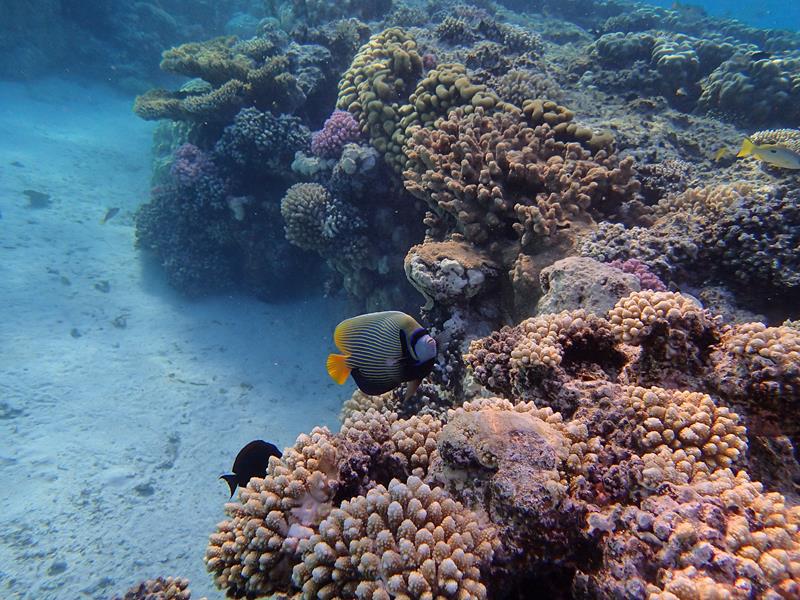
The coastline of Marsa Alam features diverse marine environments ranging from sheltered seagrass bays to protected offshore reef systems. These locations offer varied opportunities to observe Red Sea biodiversity in their natural habitats.
Known for its sandy bottom and extensive seagrass meadows, this site is a primary location for observing green sea turtles and the occasional dugong.
Look for turtles feeding in the shallower seagrass patches.
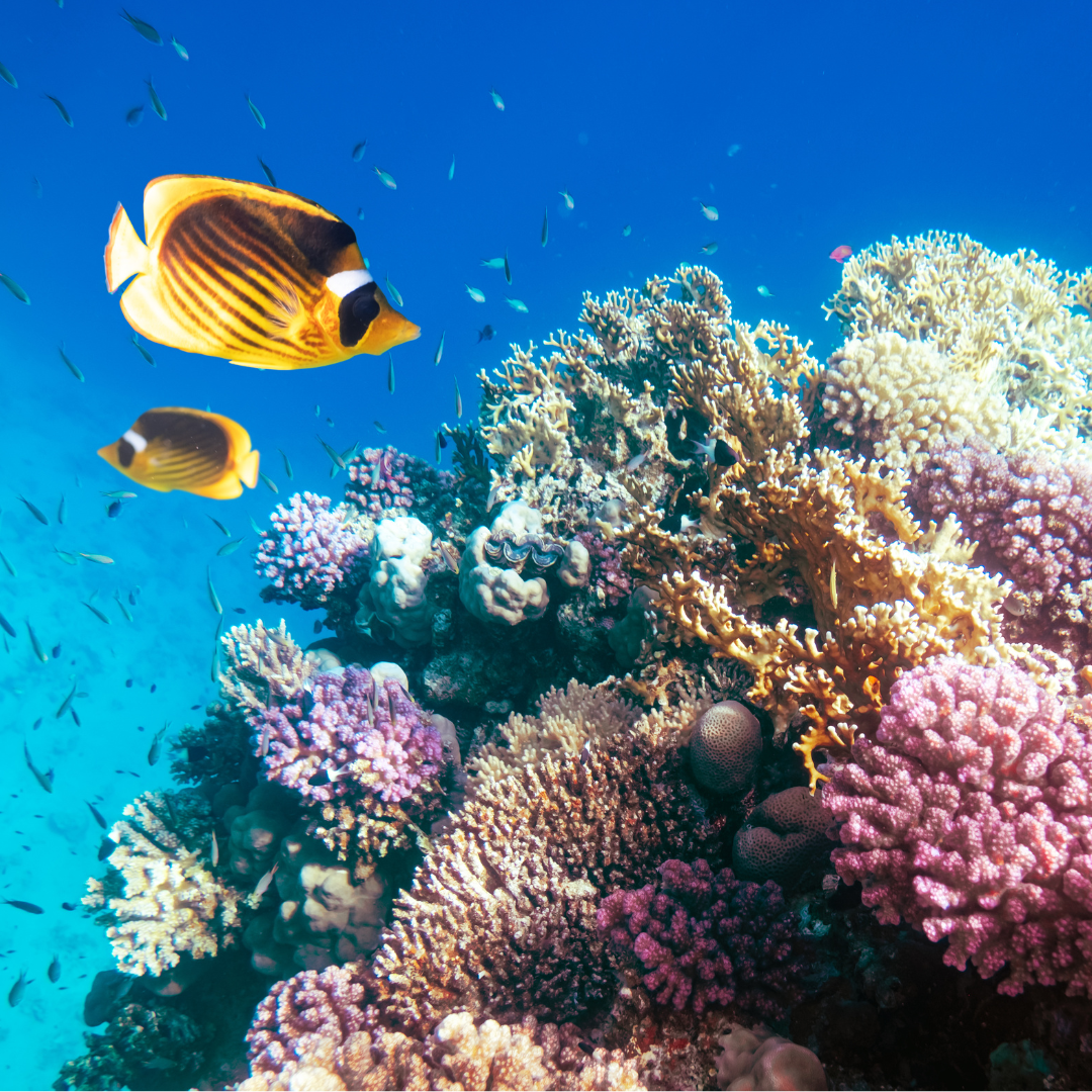
This protected bay features coral reefs along its northern and southern walls and deep seagrass beds in the center.
Swim toward the outer reef edges for higher visibility.
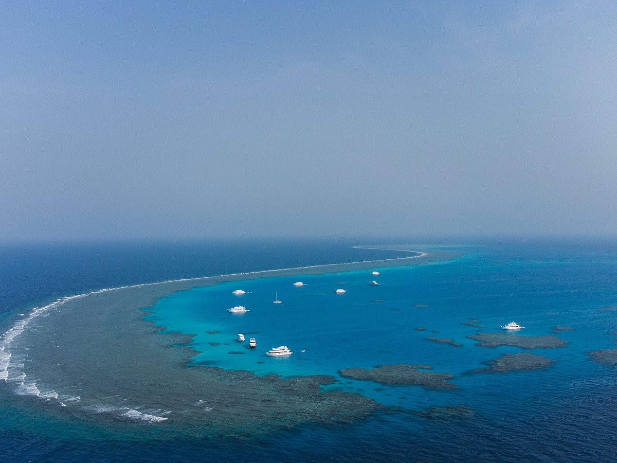
Also known as Dolphin House, this crescent-shaped reef is a protected area where spinner dolphins frequently rest.
Observe dolphins from a distance to minimize human impact.
A large, naturally sheltered lagoon that serves as a sanctuary for pods of spinner dolphins.
Position yourself near the reef drop-off for encounter opportunities.
Access to snorkeling locations in Marsa Alam typically depends on whether you are visiting public beaches or entering protected marine areas. Most public shore sites maintain free access, while boat-based tours or designated national park zones require separate entry fees.
Verdict: A typical adult pays 0 EUR for public beach access, with costs only increasing when choosing guided boat tours or entry into restricted marine parks.
Public snorkeling locations in Marsa Alam are accessible daily. While public areas remain open at all hours, visitors are encouraged to utilize the recommended morning arrival window to ensure optimal water conditions.
Marsa Alam is located along the Red Sea coast of Egypt, with most snorkeling sites accessible via the main coastal highway 24. Visitors typically reach these locations using organized transfers or private transport.
Local taxi from Marsa Alam town to coastal sites
Scheduled resort transport to snorkeling beaches
Private car hire via Marsa Alam Road
Plan to arrive between 07:00 and 08:30 to avoid mid-day crowds and ensure calmer water conditions for snorkeling.
Marsa Alam's reefs are protected marine ecosystems requiring specific conduct. Following these conservation rules preserves the dive sites marked on your snorkeling map.
Everything you need to know about marsa alam snorkeling map
A marsa alam snorkeling map helps you identify entry points, current directions, and zones protected for conservation. Focus on locating sandy channels to avoid damaging delicate coral structures while exploring. Following your snorkeling locations guide ensures you remain within safe swimming boundaries established by local authorities. Visitors should be aware that while access to many public beaches is 0 EUR, specific marine parks or guided boat tours often carry separate fees. Always verify the status of specific locations before you travel. Snorkeling alone is discouraged due to changing tide conditions and surface currents in the Red Sea. Always prioritize a buddy system when navigating sites marked on your map to ensure your personal safety. The best arrival window to visit these sites is 07:00–08:30 to avoid mid-day crowds and ensure calmer water conditions. You will often encounter sea turtles, dugongs, and diverse reef fish by visiting these locations early in the morning. While a physical or digital map is helpful for orientation, a professional guide can provide deeper context regarding protected marine species. Local guides also possess up-to-date knowledge on water visibility and daily weather changes in the Red Sea.